In 2025 Bolivia lost more primary tropical forest than any country in the world except Brazil. The figure was 1.5 million acres, slightly less than the entire surface area of the state of Delaware, gone in a single year. The University of Maryland and the World Resources Institute, who run the global tree-loss tracking that produced the number, did not bury the lead: a country with one third the population of California is now in the global top three for forest destruction.
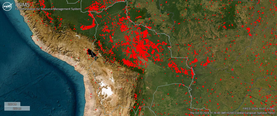
If you came to this article looking for the practical traveller’s view of Bolivia, the rest of our site is the right place. This piece is the harder one. It runs through the environmental problems Bolivia is now facing in 2026: the deforestation, the fires that burned 12 million hectares in 2024, the cooperative mining that has poisoned La Paz-region rivers, the lithium projects on the Salar de Uyuni, the glaciers that fed the highland water supply and have largely melted, and the lake that disappeared. It also covers what travellers can sensibly do about any of it. The realistic version is that the answers are smaller than the problems, but they exist.
In This Article
- The four drivers of Bolivian deforestation
- Mennonites, soy, and the question travellers ask
- The wildfires of 2019 to 2024
- Mining: the cooperatives and the contamination
- Lithium and the Salar de Uyuni question
- Glaciers and the La Paz water supply
- Lake Poopó: the lake that disappeared
- Indigenous lands and environmental governance
- The Pantanal and the cross-border story
- What the rest of the region is doing differently
- What this means for travellers
- What to keep in view
The four drivers of Bolivian deforestation
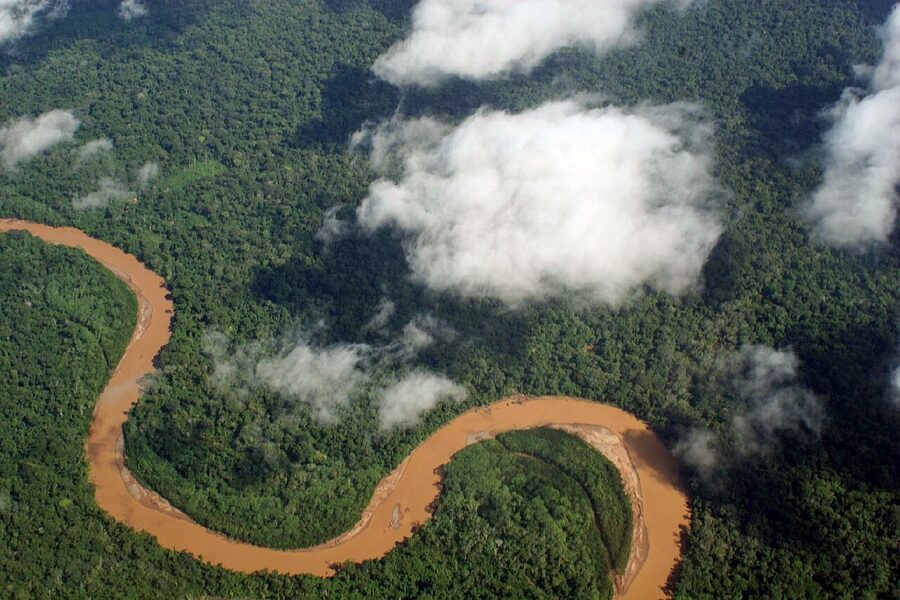
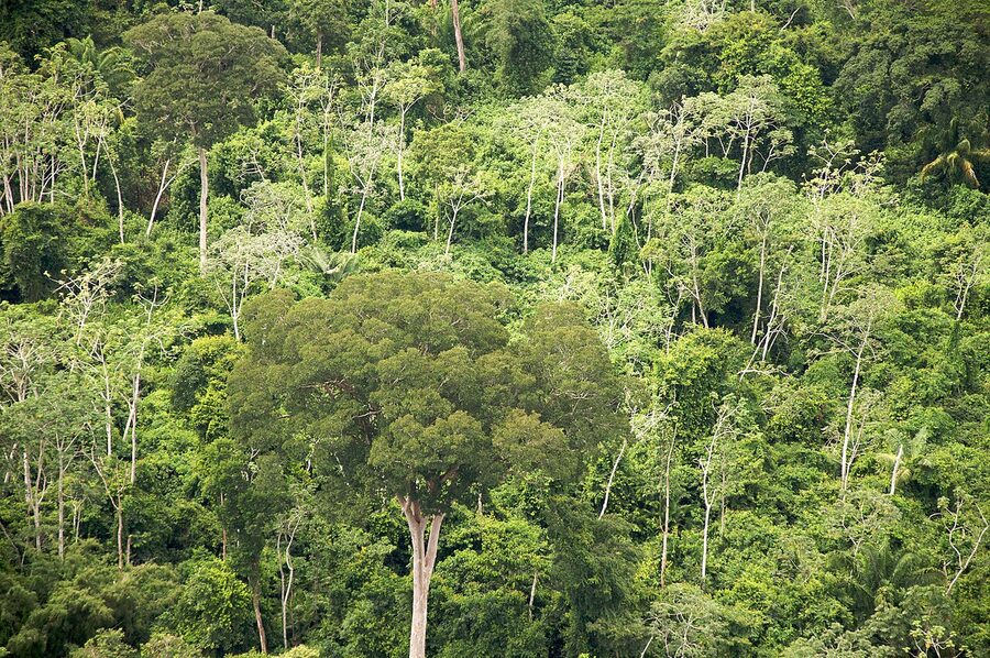
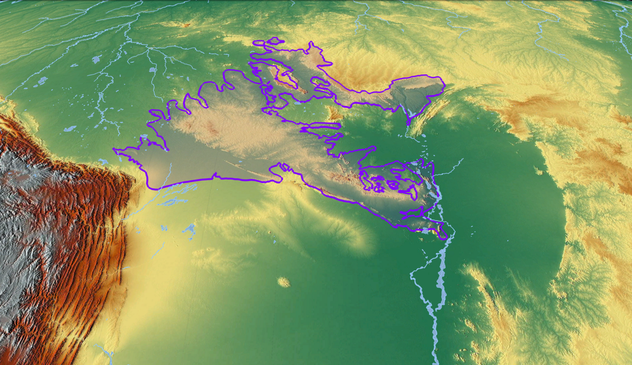
Forest loss in Bolivia is concentrated in the eastern lowlands: the Bolivian Amazon, the Chiquitano dry forest (a unique transitional ecosystem found almost nowhere else), and the Pantanal wetland that Bolivia shares with Brazil and Paraguay. Four drivers do most of the cutting, in roughly this order of impact.
Cattle ranching is the largest single driver. Bolivian cattle herds expanded from about 6 million head in 2000 to over 9 million by 2024, mostly in the lowland departments of Santa Cruz and Beni. The land-use mathematics is brutal: cleared and burned forest converts to pasture cheaply, while existing cleared pasture trades at a much higher price per hectare. Bolivian agrarian law also, by its own internal logic, encourages clearing: landowners must demonstrate “productive use” of their land or risk losing it under expropriation rules. A standing forest does not count as productive use. A herd of cattle does. The cattle boom has been driven mostly by domestic demand and exports to Peru and China; the slaughter capacity of the Bolivian beef industry roughly doubled between 2015 and 2024.
Soy farming is the second-largest driver and the fastest-growing. Bolivian soy production reached approximately 3.4 million metric tons in 2023 and is now Bolivia’s largest export crop by weight. Between 2001 and 2021, soy farms cleared an estimated 2.2 million acres of Bolivian forest, an area roughly the size of Puerto Rico. The soy is sold mostly into the global animal-feed market that supplies cattle, pig, and poultry industries in China, Europe, and the Americas; a smaller share goes to vegetable oil. The fact that beef demand drives forest loss directly through cattle expansion and also indirectly through soy expansion is one of the harder ironies for a Bolivian travel guide that just covered how good a Cochabamba chicharrón is. Both things are true; we are not pretending otherwise.
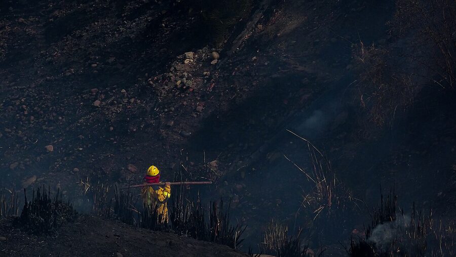
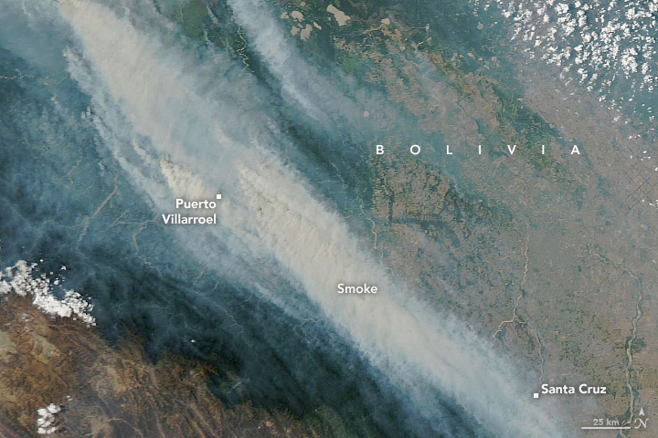
Wildfire is the third major driver, and it has become a self-reinforcing one. Farmers and ranchers in eastern Bolivia traditionally clear scrub with controlled burns, called chaqueo. Climate change has dried out the surrounding forest enough that those controlled burns increasingly escape control. The result is large-scale forest fires that, since 2019, have burned several million hectares each year. The 2024 fires were the largest environmental disaster in Bolivian history, with around 12 million hectares burned (an area larger than Portugal), more than half of it forested.
Illegal settlement and land titling is the fourth driver. Successive Bolivian governments have run “agrarian reform” programmes that grant land titles to settlers willing to clear and farm forest land. The process, designed in the 1990s and 2000s as a poverty-reduction tool, has since been used systematically to convert protected and indigenous lands into private farms. Titles issued for forested land that was then cleared run into the hundreds of thousands of hectares. The Bolivian state agency in charge of issuing the titles, INRA, has been the subject of multiple corruption investigations during the 2018-to-2024 period; some of those investigations have moved into prosecutions under the new government, although the underlying titles already issued have not generally been revoked.
Mennonites, soy, and the question travellers ask
Bolivia is now home to the largest and fastest-growing population of Mennonites in Latin America, around 100,000 people across some 90 colonies, mostly in the eastern lowlands of Santa Cruz department. Mennonite colonies first migrated to Bolivia from Canada via Mexico and Paraguay in the 1950s and 1960s. They have since expanded to the point where their soy production is estimated at between 20 and 40 percent of the national total, and they are responsible for around a quarter of soy-related deforestation in the country over the last twenty years.
This is the question travellers visiting the lowlands often ask: are the Mennonites the cause? The fuller answer is that Mennonite colonies are part of the picture but not the simple villain version of it. Their farms are mechanised in ways that other smallholder Bolivian farms are not (large tractors, herbicide-tolerant seeds, irrigated centre-pivot systems on the larger colonies), but the legal and economic incentives that make soy expansion profitable were created by the Bolivian state, not by the Mennonites. A 2023 report by the advocacy group Global Witness linked Cargill, the largest privately held company in the United States, to soy grown by Bolivian Mennonites on land that had been recently deforested. Cargill, in response, said it had not found evidence that its sourced soy came from recently deforested areas. The chain of accountability runs from the Mennonite farmer through the trader through the global feed market to the meat consumer; pinning it on any single link in that chain understates the whole structure.
The Mennonite communities themselves are not monolithic. Some colonies, particularly the more recent ones, have begun voluntarily restricting further forest clearing on their lands. Others have not. The Bolivian government has, until recently, been notably uninterested in forcing the issue. The colonies operate under a 1962 settlement agreement that gives them broad religious-community autonomy and education exemptions; the state has historically been wary of breaking that agreement, which has limited the political appetite for environmental enforcement on Mennonite-owned land specifically.
The wildfires of 2019 to 2024
The 2019 fires marked the beginning of what is now an annual ecological emergency. That year, around 5.3 million hectares burned, including the enormous Chiquitano dry forest of eastern Santa Cruz department. The Chiquitano is one of the planet’s largest remaining tracts of tropical dry forest, an ecosystem far less famous than rainforest but no less ecologically critical and arguably harder to recover. Tropical dry forest, unlike rainforest, has a long natural fire history, but the fires of 2019 burned at intensities and in dryness conditions outside that natural range. Most of the Chiquitano fires were set deliberately to clear land, then escaped.
The 2024 season was, by every measure, worse. Around 12 million hectares burned between July and November 2024, including significant portions of the Madidi, Noel Kempff, and Otuquis national parks. Madidi is one of the most biodiverse protected areas on the planet, with more bird species than any other comparable region. Noel Kempff is a UNESCO natural heritage site. Otuquis sits at the corner of the Bolivian Pantanal. All three burned. The 2024 fire season also killed at least 9 firefighters, displaced an estimated 30,000 people, and produced air quality in Santa Cruz that hit hazardous levels for weeks at a time. The Bolivian environmental NGO ProBolivia documented the death of an estimated 2.4 million wild animals in the 2024 fires, including endangered species: brown-throated sloths, blue-throated macaws (a Bolivia endemic with global population under 500), giant otters, jaguars, lowland tapirs.
Government response has been a recurring sore point. The Bolivian government, under the MAS (Movimiento al Socialismo) administrations of Evo Morales and Luis Arce that ran from 2006 to 2025, repeatedly resisted classifying the fires as a national disaster (which would have triggered international aid mechanisms). Decree 26075 and a series of subsequent regulations between 2013 and 2019 had progressively expanded the legal scope for chaqueo burning, effectively encouraging the practice. The Rodrigo Paz government elected in late 2025 has, in early 2026, begun rolling some of those decrees back, although enforcement is the harder question.
For travellers: the fire season runs roughly July through November. National parks in eastern Bolivia (Madidi, Noel Kempff, Otuquis, Amboró) are sometimes closed during peak fire weeks. Air quality in Santa Cruz can be poor for the entire dry season. Rurrenabaque and the gateway towns into the Bolivian Amazon remain visitable in most years, but the surrounding ecosystems are not what they were a decade ago, and the wildlife encounters are correspondingly thinner.
Mining: the cooperatives and the contamination
Bolivia’s mining sector is split between large-scale state and private operations and a much larger and more politically protected sector of cooperative miners (cooperativistas). Cooperatives operate under a constitutional protection that traces back to the 1952 revolution and that has, in practice, given them almost complete latitude to extract minerals without environmental oversight. Around 1,800 mining cooperatives now operate in Bolivia, mostly in tin, zinc, gold, and lithium. Cooperative miners number around 130,000 nationally and form one of the most powerful single voting blocs in the country; previous attempts to bring them under environmental regulation have collapsed in the face of nationwide blockades and protests.
The contamination consequences are documented in detail at the level of specific Indigenous Aymara communities in the highlands. Seque Jahuira, an Aymara community in the Viacha municipality of La Paz department, is one of the documented cases. As of 2025, around 26 separate mining operations were dumping waste in or near the community’s water sources. The local river runs sickly green. Cattle herds on adjacent land have died off; rabbit populations have collapsed; the population of the village itself has been driven down to a handful of holdouts. The Indigenous council leader who has organised resistance, Pastor Carvajal, was driven into temporary exile in Chile in 2024 after a confrontation with a Chinese-owned mining operation became physical.
The picture is similar in dozens of communities across the highland mining belt: in the Pailaviri area of Potosí, around the Pulacayo lead-silver mines, and in the gold-mining frontier of the lowland Amazon where mercury contamination of rivers is the dominant problem. The 2023 Bolivian government’s own environmental ministry estimated mercury contamination at levels several times above the WHO advisory limit in fish caught in tributaries of the Beni and Madre de Dios rivers. Indigenous communities downstream, who depend on river fish for protein, are showing measurable accumulations of methylmercury in hair samples studied by the University of Cartagena and the National Institute of Ecology in 2022. The Madre de Dios mercury problem is shared across the Peru-Bolivia border and is among the worst-documented environmental health disasters in the wider Amazon basin.

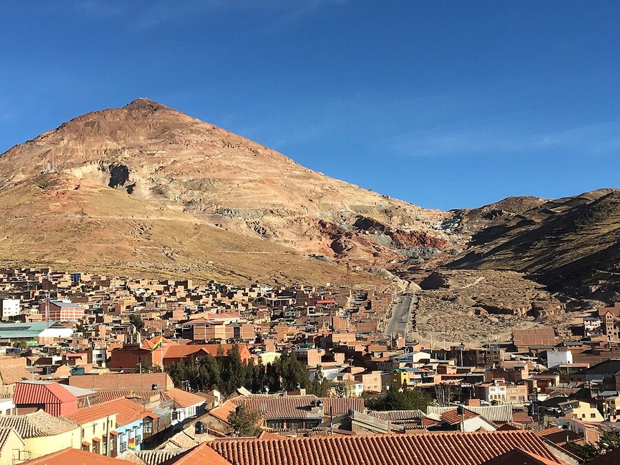
For visitors to Potosí, the famous Cerro Rico mine tours are still a daily fixture of the city’s tourism. The tours are physically demanding and ethically complicated; the cooperative miners working those tours genuinely benefit from the income, but the conditions inside the mountain are also among the most dangerous workplaces in the world, and the silicosis rates among long-time cooperative miners are high. We will cover the ethics of the Cerro Rico tours in a separate piece on Potosí.
Lithium and the Salar de Uyuni question

Beneath the salt of the Salar de Uyuni and the smaller adjacent Salar de Coipasa lies what is, by various estimates, between 21 and 23 million metric tons of lithium, the largest concentration of the metal anywhere in the world. Lithium powers the batteries that power electric cars and grid-scale energy storage, and the global price has roughly tripled since 2018 even after the 2023 correction. Bolivia is, accordingly, sitting on what governments and energy investors increasingly call “the new oil.”
The extraction question has been politically contested for nearly two decades. Evo Morales nationalised the country’s lithium reserves in 2008. The state mining enterprise, YLB (Yacimientos de Litio Bolivianos), has run a series of pilot extraction projects since 2014, none of which has produced commercial-scale lithium at the rates initially projected. In 2023 and 2024 the Bolivian government signed direct lithium extraction (DLE) contracts with the Chinese consortium CBC Investment and the Russian state company Uranium One, totalling more than $2 billion in announced investment. The new Paz government has, as of early 2026, ordered a review of those contracts but not yet cancelled them.
The environmental concern is water. Traditional brine-evaporation lithium extraction (the process used at the Atacama Salar in Chile, where the same mineral is mined) consumes around 2 million litres of water per metric ton of lithium produced. The Bolivian altiplano is among the driest inhabited regions on Earth, and the surface and aquifer water of the Salar de Uyuni is the basis of Quechua and Aymara communities’ agriculture and llama-herding economies in the surrounding villages. Direct lithium extraction (DLE) techniques use less water but more energy and generate higher costs, and the actual deployment record on the new DLE plants in Bolivia is still being established. The communities of Río Grande, Llica, and Colcha K, on the Salar perimeter, have been the most vocal in opposing the contracts; their objection is not opposition to lithium per se but to extraction terms that do not protect their water access.
For travellers visiting the salt flats: a Uyuni tour remains, in 2026, an extraordinary experience and one of the great landscapes of the world. The lithium operations are physically separated from the tourist routes and you would not see them on a standard 3-day tour. The political and environmental questions around Salar de Uyuni mining are real, and they are something a thoughtful traveller can read about and form a view on; they do not change whether the salt flats are worth visiting.
Glaciers and the La Paz water supply
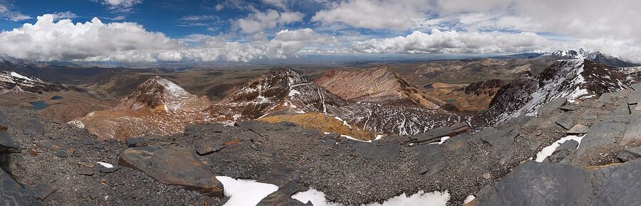
The Andes glaciers that fed the upper La Paz watershed have largely retreated. The most-cited example is the Chacaltaya glacier above La Paz, which until the late 1990s held the highest commercial ski resort in the world; by 2009 the glacier was effectively gone. The slope where the ski lift used to run is now bare rock and a small remaining cap of snow that comes and goes seasonally.
The Tuni and Condoriri glaciers, which sit higher in the same range and which together feed the La Paz drinking-water supply alongside Khara Khota and Hampaturi reservoirs, have lost an estimated 30 to 50 percent of their mass since 1980 depending on which study you read. The retreat is now well-documented and is accelerating. The 2016 La Paz water crisis, in which the city’s reservoirs dropped to roughly 10 percent of capacity and water rationing went into effect across the city for several weeks, was a direct consequence: the glacier-fed sources that historically provided seasonal storage no longer hold the volumes they used to. The 2016 crisis was, for many paceños, the moment at which climate change stopped being a global abstraction and became a household problem (timed showers, water trucks queuing on the slopes of El Alto).
The water utility EPSAS has since invested in new storage and has expanded the Hampaturi reservoir, but the medium-term outlook is that the system is operating in a structural water deficit. La Paz has roughly 1 million inhabitants and El Alto another 1.1 million; the combined city is one of the most water-stressed urban areas in South America. La Paz travellers will not feel this directly outside of an active crisis week, but the issue is permanent.
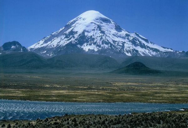
Other Bolivian glacial systems are in similar retreat. The Cordillera Real glaciers above La Paz have lost roughly 40 percent of their mass since 1985. The Sajama glacier on the highest mountain in Bolivia is shrinking rapidly. The downstream consequences are felt by indigenous communities at the foot of those mountains who relied on glacier melt for late-season irrigation: as the seasonal snowpack diminishes and the underlying glacial reserve shrinks, the irrigation window contracts. In communities around Charazani and Curva (Apolobamba), and across the highland Aymara villages around Sajama, traditional crop calendars set by the August snowmelt are no longer reliable; planting schedules have been pulled forward by several weeks, with mixed success. The University of Sussex’s “Glaciers and Communities” project, ongoing since 2018, has documented the downstream agricultural reorganisation in detail.
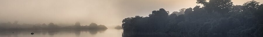
Lake Poopó: the lake that disappeared
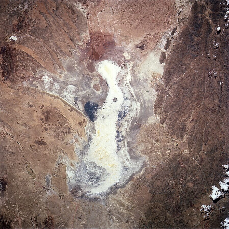
Lake Poopó was, for most of recorded history, Bolivia’s second-largest lake, a shallow saltwater lake of around 2,300 square kilometres in the Oruro department. By December 2015 it was almost entirely dry, with surface area dropping to around 30 square kilometres. The Bolivian government in 2016 declared the lake “evaporated” and stated that recovery was uncertain.
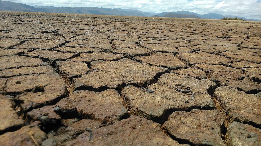
The drivers were a combination of long-term: water diversion for agriculture upstream of the Desaguadero river that fed the lake; mining contamination from the Oruro region; and climate-driven reduction in the rainfall that historically kept the lake topped up. By 2016, the Uru-Murato people who had lived as fishermen on the lake for thousands of years (and who self-identify as one of the oldest continuously inhabited groups in the Americas) had been forced to abandon their traditional livelihood. Most of the surviving Uru-Murato now live as labour migrants in Oruro and other altiplano towns. The community lost not only its food source but its language: Uchumataqu, the Uru-Murato language, has very few fluent speakers remaining, and the cultural knowledge passed across generations on boats and at fish markets has not transferred to urban contexts.
The lake has partially refilled in some recent rainy seasons, but the structural problem (less rainfall, more upstream extraction, accumulated salt and contamination on the lakebed) remains. It is unlikely to recover its historic surface area without major upstream water-management changes. As of early 2026, the lake’s surface area fluctuates between roughly 200 and 800 km² seasonally, less than half its historical norm.
Indigenous lands and environmental governance
About 60 percent of Bolivia’s population is Indigenous, the highest proportion of any country in South America. The Bolivian constitution adopted in 2009 grants extensive rights to Indigenous peoples, including over their ancestral lands, called Tierras Comunitarias de Origen (TCOs). On paper, this is among the most progressive Indigenous land-rights frameworks anywhere in Latin America. In practice, the gap between the legal framework and the on-the-ground enforcement has widened.
The pattern that has emerged is consistent. Government agencies issue settlement permits, mining concessions, or agricultural titles on land that overlaps with TCOs or with national parks. The affected Indigenous communities resist through legal channels, the cases drag through Bolivia’s slow courts, and meanwhile the deforestation or extraction proceeds. By the time legal resolution arrives (sometimes ten years later), the underlying ecosystem is already substantially altered. The TIPNIS national park dispute (Territorio Indígena y Parque Nacional Isiboro Sécure), where the Morales government tried to push a road through Indigenous land in 2011, became the canonical case. After three Indigenous marches on La Paz, the road project was paused, then quietly restarted in segments, then paused again under court ruling. As of 2026 the formal road through the centre of TIPNIS has not been built, but a network of access roads on the perimeter has effectively achieved much of what the original plan would have done.
Indigenous-led conservation has, in some places, been the most effective brake on the wider extraction economy. The Wapichan and Mosetén-Leco communities in the upper Beni river have run successful community-based forest monitoring programmes, sometimes with NGO support. The Tacana people of the Madidi region have managed a protected zone with measurably lower deforestation than non-Indigenous lands of similar geography. The pattern that emerges across multiple peer-reviewed studies is that Indigenous-managed land in Bolivia loses forest at roughly half the rate of comparable non-Indigenous-managed land. The policy implication is straightforward, and absent in the actual policy debate.
The Pantanal and the cross-border story
The Bolivian Pantanal is the western edge of the world’s largest tropical wetland. The whole Pantanal spans roughly 200,000 km² across Bolivia, Brazil, and Paraguay; about 20 percent of the system sits on the Bolivian side. The Bolivian portion has been hit twice in recent years by major fire events (2020 and 2024) that burned large portions of the wetland’s edge and the surrounding Chaco-Pantanal transition forest. The fires have set back jaguar and giant otter populations across the broader Pantanal, although the Brazilian side has made some recovery progress in 2025 under stronger enforcement.
The cross-border dimension matters because the drivers and the protections do not stop at the border. The Paraguay River, which runs through the Pantanal, is the shared lifeline. Upstream water diversions in Brazil affect Bolivian Pantanal flows; deforestation in the Brazilian Cerrado affects rainfall in the Bolivian Chiquitano. Bolivia, Brazil, and Paraguay have a coordination framework called the Pantanal Tripartite Agreement, signed in 2018, but enforcement of the agreement has been slow.
What the rest of the region is doing differently
The Bolivian environmental story would be more depressing if it were not for what is happening next door. Brazil, which holds about 60 percent of the Amazon basin, recorded a 42 percent drop in primary forest loss in 2024 compared to 2023, according to the World Resources Institute’s analysis. The drop coincides almost exactly with the second presidential term of Luiz Inácio Lula da Silva, who took office in January 2023 with a comprehensive anti-deforestation agenda. The Lula plan included re-establishing the Action Plan for the Prevention and Control of Deforestation, hiring back several thousand environmental enforcement officers who had been laid off under the prior Bolsonaro administration, and creating new protected areas. The policy package is concrete and replicable.
Colombia, smaller but in similar geography, has run a comparable programme. In early 2025 the Petro administration formalised a regulation that grants rural communities legal use rights over forest land conditioned on those communities keeping the forest standing. Forest loss in the affected regions dropped by an estimated 35 percent in the year that followed.
Costa Rica, smaller still and outside the Amazon basin but a frequently-cited reference, reversed deforestation between 1986 and 2010 by combining a payment-for-ecosystem-services programme with a hard ban on deforestation in private forest. The country went from one of Latin America’s worst forest-loss records to global net forest gain. The mechanism (paying landowners to keep forest standing, paid for by a small fuel tax) has been studied as a possible Bolivian model, although the political economy of getting it adopted in Bolivia is harder.
The implication for Bolivia is that the trajectory is not pre-determined. Forest loss can be reduced quickly when a government decides to reduce it. The new Rodrigo Paz administration that took office in November 2025 has signalled that environmental enforcement will be a priority; the early steps (suspending several large land-titling decisions, increasing the budget of the Forestry Authority, beginning the rollback of fire-permitting decrees) have been small but in the right direction. Whether they translate to a real change on the ground is the question of the next two to three years.
What this means for travellers

A few practical considerations for visitors who want to engage with this thoughtfully without becoming preachy or self-flagellating about it.
National parks are mostly still worth visiting. Madidi, Noel Kempff, Amboró, the Pantanal: all have suffered fire damage, all retain enormous areas of intact forest. Visiting them, paying park entry fees and using local guides, materially supports the protected-area system. Most Madidi tour operators in Rurrenabaque are themselves Indigenous-owned cooperatives; the income flows directly to the communities most affected by surrounding deforestation. Aim for July to October on dates outside peak fire weeks. Specific operators worth knowing: Chalalán Ecolodge (Tacana community-owned), Madidi Travel, Mashaquipe Eco-Tours.
Beef is more complicated. Bolivian beef is a staple of the cuisine and skipping it in markets and comedores would be performative more than effective. The supply chain for high-end restaurant beef is more identifiable than for street and market beef, and is more often connected to the recently cleared lowland ranches; the silpancho at a market comedor is more likely to be sourced from an old-pasture farm. We are not telling anyone what to eat. Reading our traditional cuisine guide alongside this article gives you a fuller picture.
The Salar de Uyuni is still the right thing to visit. The lithium extraction is geographically separate from the standard tourist routes, the Salar’s surface is structurally fine, and the visit supports a range of Quechua-owned operators in the surrounding towns. Read up on the lithium question before you go and let it inform your choice of operator. Operators based in the village of Colcha K and run by community cooperatives keep more of the income local.
Cerro Rico tours are a genuine dilemma. The tour income matters to the cooperative miners, but the working conditions are dangerous and the silicosis rates are real. If you visit, do so with a guide who is themselves a miner or a former miner (Big Deal, Real Deal, and Koala Tours all employ such guides) and pay respectfully.
Carbon-offset arguments are not a substitute for any of this. Buying offsets from Bolivian programmes is fine; we will not bog the article down arguing about which schemes are reputable. Offsets are not ethically neutral, and they are not an alternative to the underlying choices.
What to keep in view
Bolivia’s environmental crisis is not a story of inevitable decline. The deforestation rate can be reduced quickly when policy changes; the Brazilian and Colombian recent record is the proof. The water deficit in La Paz can be partially offset by reservoir investment, and the city has begun making it. The 2024 fire season is not a permanent annual baseline; the chaqueo decrees that authorised much of it can be repealed, and have begun to be.
What is harder to undo is the loss of irreplaceable ecosystems: the Chiquitano dry forest that has burned in the last seven years was a globally unique ecosystem and most of it is not coming back in a recognisable form on a human timescale. The Lake Poopó that the Uru-Murato fished for two thousand years is gone. The glaciers above La Paz are not refreezing. These are real losses and the article should not pretend otherwise.
For a country in 2026 to be the second-most-deforesting place on Earth is a chosen outcome, not an inevitable one. The choice was made by a particular set of policies, executed by a particular set of governments, lobbied for by a particular set of agricultural and mining interests, and consented to by a particular set of voters. Those things can change. Whether they will, in Bolivia in the next decade, is the question on which the rest of this page depends.
.jpg)