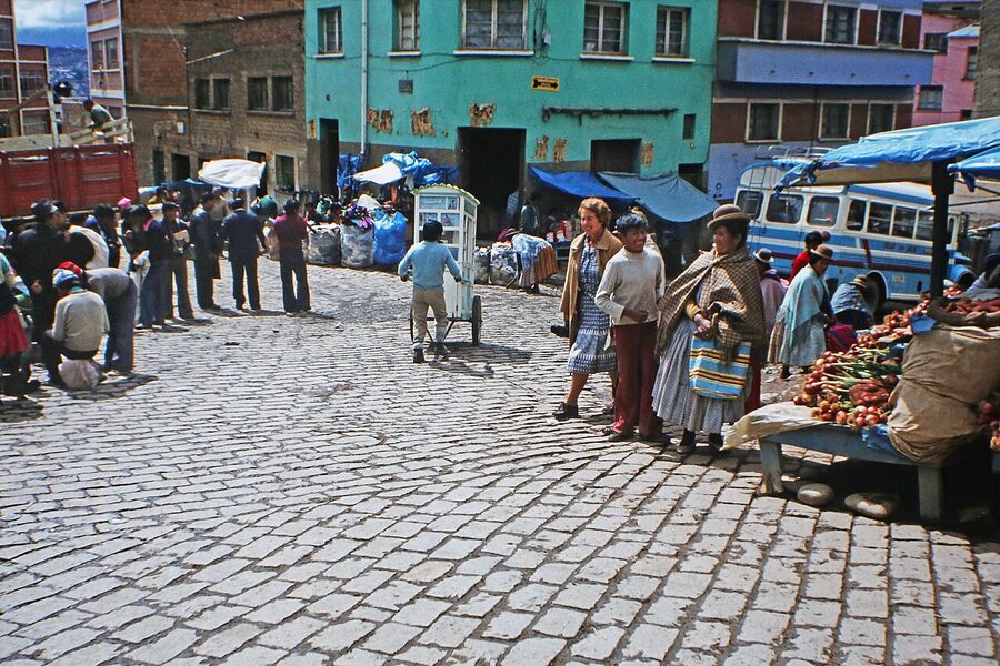
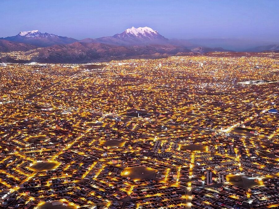
The first thing to understand about La Paz is that the city is built into the wall of a canyon. The administrative centre sits at around 3,650 metres, the high suburbs of Achumani drop to 3,200, and El Alto on the rim above climbs to 4,150. You will spend your first hours in the city catching your breath on small uphill walks, drinking your first cup of mate de coca, and adjusting to the rhythm of a place where altitude is a constant variable. Pace your day. Most travellers who push for a full agenda on day one regret it by 9pm.
.jpg)
This is the long guide to La Paz. The city is the political and cultural capital of Bolivia (the constitutional capital is Sucre, but every meaningful institution sits here), and it deserves more than the standard one-day tourist circuit. We cover the altitude, the cable car system that travelers underrate, the neighborhoods, the markets, the day trips, where to stay, and the things genuinely worth skipping. The companion cuisine and drinks guides cover what to eat and drink in detail; this article focuses on getting around and what to see.
In This Article
- The altitude question
- How La Paz is laid out
- Mi Teleférico: how to use the world’s largest urban cable car
- Plaza Murillo and the colonial centre
- The Witches’ Market
- The markets where Bolivians shop
- Cholita wrestling
- Day trips: Death Road, Valle de la Luna, Tiwanaku
- Sopocachi: where to go in the evening
- El Alto: the rim city
- Where to stay by neighborhood
- Money, language, and the practical
- What to skip
The altitude question
La Paz sits high enough that perhaps 1 in 5 visitors will feel some level of altitude sickness on the first day. The symptoms are headache, mild nausea, shortness of breath on small climbs, occasionally trouble sleeping. They typically resolve within 24 to 48 hours as your body adjusts. None of the symptoms are dangerous if you handle them right.
The standing advice is mate de coca on arrival, plenty of water (4 to 5 litres on day 1), no alcohol on day 1, light food only, and the most useful: do not push the hiking. Your hostel will offer coca leaves; chew them or drink the tea. If you are arriving from sea level, even a slow walk uphill in the centre will leave you out of breath. That is normal. If you are flying in directly from Lima or San Francisco, you may want to start your trip with a couple of nights at lower altitude (Cochabamba is 2,560m, Santa Cruz is 415m) before climbing into La Paz. Our altitude sickness piece covers the full medical picture.
The local pharmacy chains (Farmacorp is everywhere) carry sorochipills, a Bolivian acetazolamide-and-coca tablet that is the standard pharmacy recommendation. They cost around 30 BOB for a strip and work for most people; if you have known altitude problems, talk to your own doctor before travelling and consider starting acetazolamide a day before arrival.
How La Paz is laid out
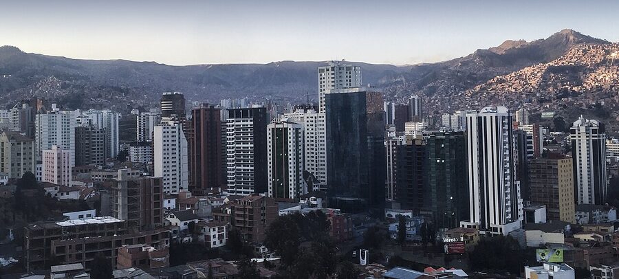
The city’s vertical structure is what shapes everything. The Choqueyapu river runs through the canyon floor; the city has been built up the canyon walls on both sides, with the wealthy southern districts (Calacoto, Achumani, San Miguel) sitting lowest at around 3,200m and the working-class northern and western neighborhoods rising to El Alto at 4,150m. The political-administrative centre (Plaza Murillo, Plaza San Francisco, the bus and train terminals) sits in the middle band around 3,650m.
The practical implication: when you walk from the centre toward El Alto you are going uphill at altitude, which is harder than it sounds. When you go to Calacoto for dinner you are going downhill, which is fine on the way out and brutal on the way back. The cable car system, which we cover next, exists because the city’s gradient defeats walking for any meaningful distance.
The neighborhood breakdown matters because each one has a distinct character.
- Centro / Casco Viejo: the colonial-era historic centre. Plaza Murillo, the cathedral, the government buildings, Calle Jaén (the most photogenic colonial street). Most short-stay travelers will base themselves here.
- San Pedro: just south of the historic centre. The infamous San Pedro prison sits on the plaza here (do not attempt to enter; the tours that operated until 2009 are illegal now). The neighborhood itself is a working middle-class area with good comedores.
- Sopocachi: the bohemian / cultural / professional district, home to Bocaisapo, Higher Ground, and most of the bars and restaurants you would actually want to visit at night. Plaza Avora and the surrounding streets are the heart.
- Miraflores: across the canyon from the centre, mostly residential, walkable colonial-era area with the Estadio Hernando Siles (the country’s main football stadium).
- Calacoto / San Miguel / Achumani: the southern wealthy districts, almost a separate city. Lower altitude (around 3,200m), warmer weather, modern shopping centres. Gustu sits in Calacoto. Many international expatriates and Bolivian upper class live here.
- El Alto: the rim city above La Paz, technically a separate municipality with its own government and over 1.1 million inhabitants. Indigenous-majority, working-class, the city’s cultural and political pulse. Cholita wrestling, the Sunday Ferias del Alto markets, the airport.
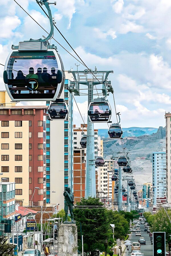
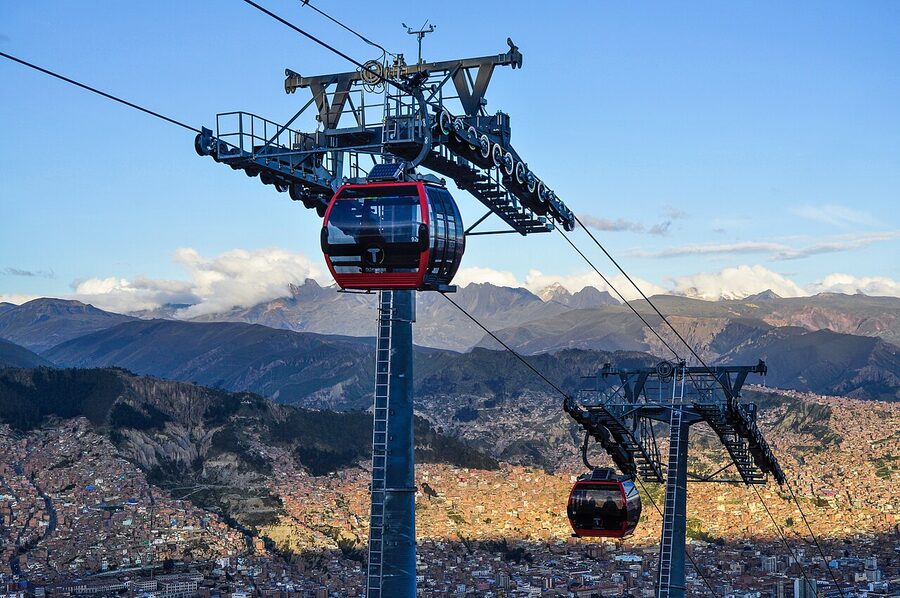
Mi Teleférico: how to use the world’s largest urban cable car
The Mi Teleférico cable car system is the single best thing about getting around La Paz, and most short-stay travelers underuse it. Built in three phases starting in 2014 and completed in 2019, the system has 10 colour-coded lines and 32 stations covering the whole metropolitan area, including the El Alto rim. It is the largest and longest urban gondola network in the world, longer than any equivalent in Europe or Asia.
How to use it: each ride is 3 BOB (about 0.45 USD). Tap your card at the entry turnstile (you can buy a reloadable Tarjeta Mi Teleférico card at any station for 15 BOB on first purchase plus a starting balance). Lines run roughly 5am to 10pm. The transfers between lines are free if you stay inside the system. You will get more out of three days in La Paz with a Teleférico card than you would walking; stations connect to almost every neighborhood you would want to visit.
The most useful lines for travelers:
- Red Line (Línea Roja): from the central station near the bus and train terminals, up to El Alto and the rim. The 8-minute climb gives you the canonical La Paz panorama. Take it at sunrise (5:30 to 6am) for the best light, or sunset (5:30 to 6:30pm) for the city lit up below.
- Yellow Line (Línea Amarilla): connects the centre to Calacoto in the south. The 25-minute ride takes you across the city and over the canyon for a great cross-section view.
- Green Line (Línea Verde): from the centre to the southern Zona Sur, useful for getting to dinner at Gustu or Popular Cocina Boliviana.
- Sky Blue Line (Línea Celeste): connects El Alto stations laterally; useful for reaching the El Alto markets on Thursday and Sunday.
Practical: stations have toilets, wifi, and small cafés. Avoid Friday and Saturday evening rush (5pm to 7pm) when commuter volume from El Alto fills the cars. Sunday is the quietest day. The cable cars are heated; they get cold at peak altitude on a winter night.
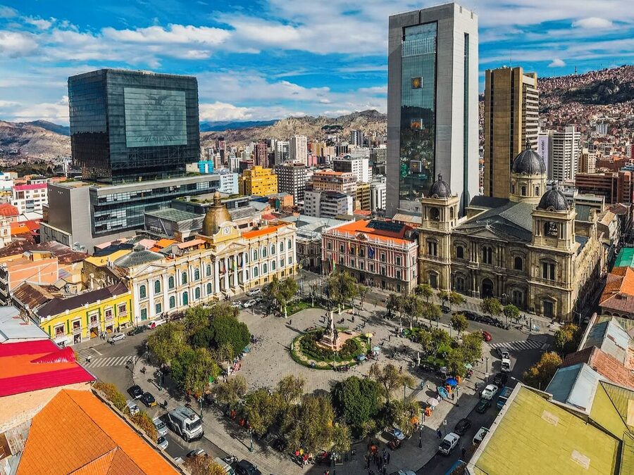
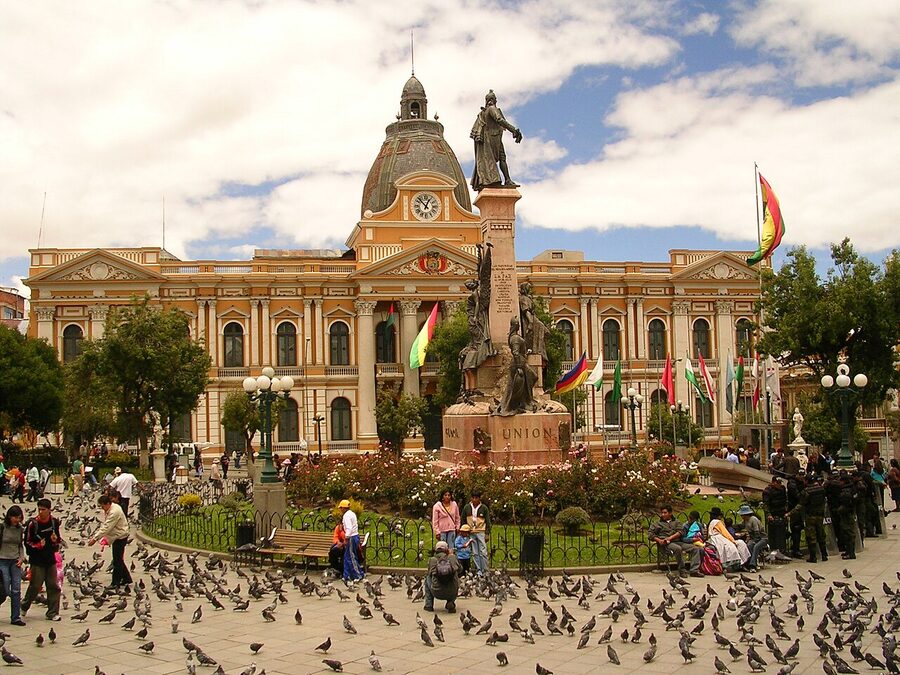
Plaza Murillo and the colonial centre
Plaza Murillo is the political and historical centre of Bolivia. The Catedral Metropolitana (build 1835), the Palacio Quemado (the presidential palace, called the “burned palace” because it has been set on fire several times in coups), the Bolivian Congress, and the National Museum of Art all sit on or just off the square. The plaza is named for Pedro Domingo Murillo, leader of the 1809 La Paz revolution that started Bolivia’s independence movement.
.JPG)
Around the plaza: Calle Jaén, see image below, is the most photographed colonial street in the city, narrow and stone-paved, lined with five small museums (the Coca Museum, the Folklore Museum, the Costumbrista Museum, the Casa de Murillo where the independence leader was hanged, and the Museo del Litoral about the lost coastline to Chile). Each museum is around 15 BOB and small enough to be done in 30 minutes. The Casa de Murillo and the Museo del Litoral are the most worthwhile.


The San Francisco basilica on Plaza San Francisco, ten minutes’ walk from Plaza Murillo, is the city’s most striking church and has free entry; the cloister tour for 20 BOB takes you through the rooftops with a city view. Plaza San Francisco itself is the political demonstration site of the city; you will often see protests, marches, or Aymara cultural events here.
The Coca Museum on Calle Linares is small (one room, around 30 minutes to read through) but is the best primer on the cultural history of the coca leaf in the Andes; the wider context is in our coca customs and rituals piece. Around 20 BOB entry.
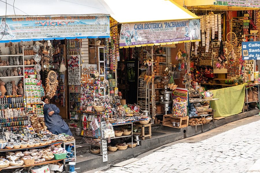
The Witches’ Market
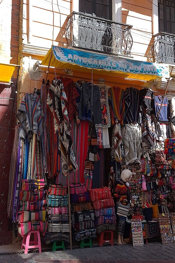
The Mercado de las Brujas (Witches’ Market) on Calle Linares is the city’s most famous tourist destination and one of its most genuine cultural artifacts. The market sells items used in Aymara ritual practice: dried llama foetuses (offerings to Pachamama buried under new buildings), ekekos (small clay figures of the wealth god, weighed down with miniature objects representing what the buyer wants), aguayo cloths, herbs for spiritual cleansing, traditional medicines. The yatiri shamans who actually perform the rituals work from small storefronts on the same street; their consultations cost 30 to 80 BOB and include a coca-leaf reading.
-8.jpg)
The market sits two blocks above Plaza San Francisco. Calle Sagárnaga, which runs through the same area, is the broader tourist shopping street with alpaca textiles, silver jewelry, and souvenirs. Prices on Sagárnaga are negotiable; expect to talk a 20-30 percent discount off the first quoted price. The aguayo bags and cloths are reasonable buys at around 80 to 200 BOB; alpaca scarves are 50 to 120 BOB depending on quality.
What to skip: the very-tourist hostels on the same street that promote “shaman experiences” with English-speaking guides for 200 BOB; they are mostly performance, not ritual. If you want a real coca-leaf reading, walk into one of the storefronts on Linares and ask in Spanish.
The markets where Bolivians shop
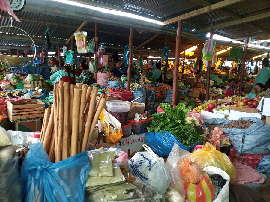
If the Witches’ Market is the tourist market, Mercado Rodríguez and Mercado Lanza are where Bolivians shop. Mercado Rodríguez (between Calle Rodríguez and Calle Max Paredes) is the larger of the two, with three densely packed levels of fresh produce, meat, fish, dry goods, and prepared food. The api stalls on the upper floor open at 6am and serve api con pastel through about 11; the chairo and fricasé comedores serve from noon to 3.
Mercado Lanza, north of Plaza San Francisco, is smaller and more concentrated on prepared food. The upper food court has thirty-plus comedores serving everything from sopa de maní to silpancho for around 30 BOB. Both markets are the right place to learn Bolivian food in a way that the sit-down restaurants in the touristy zones cannot teach you.
Calle Max Paredes, which runs alongside Mercado Rodríguez, is also a sprawling textile and clothing district. If you are buying alpaca for real (not for the souvenir-grade quality on Sagárnaga), the wholesale shops on Max Paredes have better fibers at around 60 percent of Sagárnaga prices. Bring small bills.
Cholita wrestling
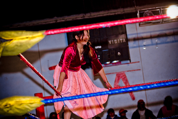
Cholita wrestling is the El Alto theatre experience. Indigenous Aymara women wrestle each other (and male wrestlers, often) in full pollera dress, in a Sunday-afternoon staged-wrestling format that is part lucha libre, part political theatre, part feminist statement. The cholita wrestlers (the Luchadoras Bolivianas, founded around 2001) have been celebrated internationally as a form of indigenous female empowerment, and the matches in the El Alto Multifuncional arena have become one of La Paz’s iconic visitor experiences.
Practical: matches are most Sundays at 4pm at the Multifuncional in El Alto. Tickets are around 80 BOB for tourists (nominally a higher price than for locals, though enforcement varies). The hostel in your area can arrange transport or you can take the Red Line cable car to El Alto and a short taxi from there. The matches run for about 2.5 hours with two halves of about 5 fights each. The wrestling is staged but the cultural context is real and the audience is mostly local El Alto families. Sit closer than you think; the front rows get the spectacle.
What to know: this is genuinely a working-class community event, not a tourist attraction performed for foreigners. Treat it as such. Buy refreshments from the local vendors at the arena rather than bringing your own.
Day trips: Death Road, Valle de la Luna, Tiwanaku
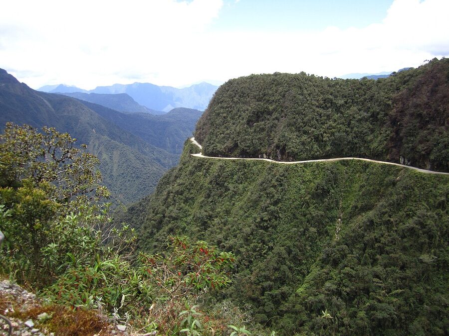
.jpg)
Death Road / North Yungas Road cycling is the headline day trip from La Paz. The 64-kilometre descent from La Cumbre at 4,650m down to Coroico at 1,200m drops you 3,500 vertical metres on a road that, before the paved bypass opened in 2007, was responsible for an estimated 200 to 300 deaths per year. The cycling tour is now the dominant use; tour operators run the route most days from May to October.
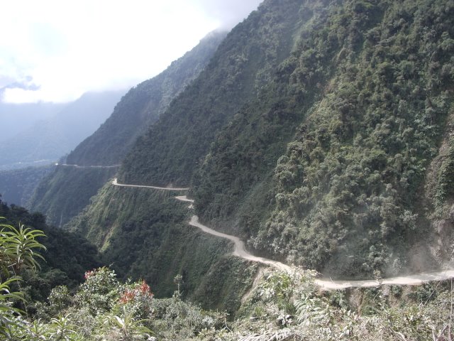
Pick your operator carefully. The reputable companies (Gravity Bolivia, Vertigo Biking, Barracuda Biking) use full-suspension downhill bikes, run support vehicles, supply protective gear, and have safety records that have improved enormously in the last 15 years. Cheaper operators using harder-tail bikes and less experienced guides have meaningfully worse safety records. The price for a reputable tour is 380 to 500 BOB; the price for a cheaper operator is 250 to 320. The savings are not worth the safety reduction.
The day starts with a 7am pickup, drives 45 minutes to La Cumbre, runs about 6 hours of riding with breaks, and ends at a small lodge in Coroico for showers and lunch. The tour operators drive you back to La Paz that evening (about 3 hours). It is a long day. You will be physically exhausted; do not plan anything for the following morning.
-35.jpg)
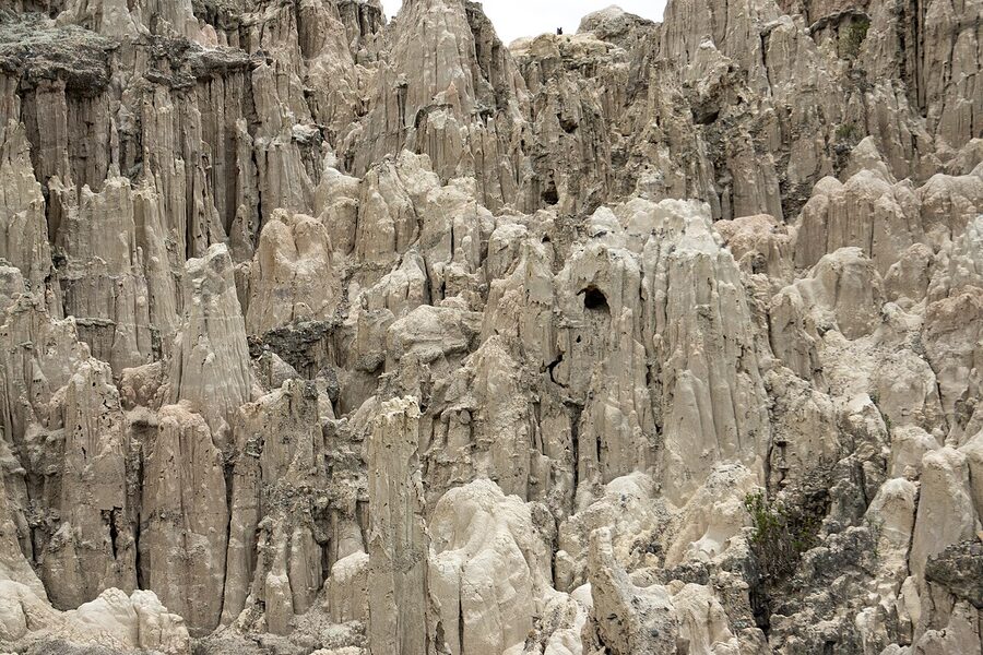
Valle de la Luna is the half-day option. The eroded clay-and-sandstone landscape sits at the southern edge of the metropolitan area, accessible by a 30-minute taxi or by Yellow Line cable car plus a short walk. The two trails (a short 15-minute loop and a longer 45-minute one) cover most of the formations. Entry is 15 BOB. Pair with a lunch at one of the Calacoto restaurants on the way back. It is a worthwhile half day but not the kind of landscape you would travel cross-country for.
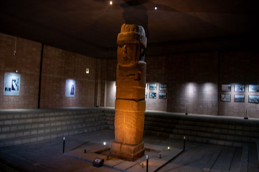
Tiwanaku is the full-day archaeology trip. The pre-Inca site, 70km west of La Paz, was the centre of the Tiwanaku civilisation that dominated the southern Andes from around 200 to 1000 CE, then collapsed roughly 500 years before the Inca empire emerged from Cuzco. The site is a UNESCO World Heritage Site and includes the Akapana pyramid, the Kalasasaya temple complex, the famous Sun Gate (Puerta del Sol), and two thoughtful on-site museums.
How to do it: take a half-day tour from La Paz (around 200 to 280 BOB through any hostel), or go independently by mini-bus from Cementerio General terminal (15 BOB each way, about 90 minutes). The site entry is 100 BOB for foreigners. Allow 3 hours on site. The combined tour-and-entry cost through a hostel works out about even with the independent option, so unless you want to set your own pace, the tour is fine.
Other day-trip options worth knowing about: Chacaltaya (the former glacier and former ski resort, half-day), Lake Titicaca and Copacabana (the standard route is to make this a 2-day overnight rather than a day trip; we cover it in the Copacabana piece), the Yungas town of Coroico (worth a 2 to 3 day stay if you do the Death Road cycle and want a soft landing).
Sopocachi: where to go in the evening
Sopocachi is where La Paz drinks and eats out. The bar and restaurant district runs roughly along Calle Belisario Salinas and Calle 6 de Agosto, with Plaza Avora and Plaza España as the anchor squares. From the centre, it is a 25-minute walk downhill or 15 minutes by taxi.
For drinks (covered in detail in our drinks guide): Bocaisapo for chuflays made with fresh ginger ale, Higher Ground for the modern singani-forward menu, Magick Cantina Café for the bohemian crowd, Diesel Nacional on Calle Federico Zuazo for cheap beer rounds. The bars start filling around 9pm and run until 2 or 3am.
For dinner: Ali Pacha (vegan altiplano cooking, about 280 BOB), Popular Cocina Boliviana (5-course Bolivian tasting at lunch only, 95 BOB), Café del Mundo (relaxed neighborhood spot, 80 to 120 BOB), and the corner pizzerias and steakhouses for cheaper. Reservations are not generally needed except at Gustu (in Calacoto, southern district, requires 5 to 7 days notice for the tasting menu; 600 to 900 BOB).
El Alto: the rim city
El Alto deserves more time than most travelers give it. Sitting on the rim above the canyon at 4,150m, El Alto has roughly 1.1 million inhabitants (more than La Paz proper), is technically a separate municipality, and has its own city government, mayor, and identity. It is around 80 percent Indigenous Aymara, mostly working class, and was the political pulse of the 2003 Gas War that brought down the Sánchez de Lozada government.
What to actually do up there:
- El Alto markets on Thursday and Sunday: the largest open-air market in South America, sprawling over many blocks around 16 de Julio Avenue. Everything from livestock to electronics to Aymara textiles. Go early (8am to 11am is the busy window).
- Cholita wrestling: covered above. The Multifuncional arena is a 20-minute walk from the El Alto cable car terminus.
- Neo-Andean architecture tour: the architect Freddy Mamani has, since the late 2000s, built around 80 of the bright pink, blue, and gold “cholet” mansions across El Alto. The style is genuinely new (a fusion of Aymara colour symbolism, Tiwanaku motifs, and contemporary architecture) and is now part of architectural-history syllabi worldwide. The unofficial tour starts at the cholet on Avenida Costanera near the cable car terminus; you can walk between several in an afternoon.
- The Alto Hospicio Park overlook: walk 15 minutes from the Yellow Line terminus for the best canyon view of La Paz proper, particularly at sunset.
What to know practically: El Alto is colder, drier, and more wind-blown than La Paz. Bring a layer. Take the cable car back down by 8pm; while El Alto is broadly fine to walk around in daylight, the main commercial streets feel quieter at night and a taxi is the better call.
Where to stay by neighborhood
Centro / Casco Viejo is the obvious choice for a first-time short visit: walking distance to Plaza Murillo, the markets, and the cable car. Loki La Paz (Calle Loayza) is the budget hostel, around 80 to 120 BOB per dorm bed. Wild Rover (Calle Comercio) is the party hostel, similar pricing. Casa Fusión (Calle Murillo) is the mid-range pick at around 280 to 400 BOB for a private double. The Hotel Stannum (Calle Aspiazu) is the higher-end option at 700 to 1,200 BOB.
Sopocachi is the right call for travelers who want the bar scene: Casa de los Espíritus and Hostal República both offer mid-range comfort at 250 to 380 BOB. The Atix Hotel (Calle Rafael Bustillos) is the boutique upper-mid option.
Calacoto / Zona Sur is for travelers who want the lower altitude (3,200m vs. 3,650m makes a real difference for sleep) and the modern conveniences. The Camino Real and the Casa Grande are the two reliable upper-tier hotels at 800 to 1,500 BOB. The downside is you are 30 minutes from the historic centre and need to use the cable car or taxi for everything.
For the budget-conscious looking for a real Bolivian experience, Hostal Naira (Calle Sagárnaga) is the long-running family-run guesthouse at 80 to 200 BOB, or any of the small alojamientos around the Mercado Lanza area at similar prices.
Money, language, and the practical
Money: ATMs are universal in the centre and Calacoto; the Banco Nacional de Bolivia, Banco Bisa, and Banco Mercantil ATMs accept Visa and Mastercard. Withdrawal limits are typically 2,000 BOB per transaction with a 30 BOB foreign-card fee. US dollars are accepted at hotels, tour operators, and upper-end restaurants; the exchange rate is the official 6.96 BOB per USD or close to it. Cash in 50 and 100 BOB notes is the everyday currency.
Language: Spanish and Aymara are both widely spoken; many older market vendors in El Alto speak Aymara as a first language. English is limited to the tourist-facing zones (Sagárnaga, Sopocachi nightlife, the upper hotels). Even basic Spanish helps enormously; a 30-hour DuoLingo investment before the trip pays off.
Taxis vs Uber: Uber works in La Paz and is generally a better option than street-flagged taxis for safety and pricing. Inhouse taxis booked through your hotel (radio taxis like Gibraltar, Albor, or Carbel) are also reliable; a taxi from the centre to Calacoto runs around 40 to 60 BOB. Avoid unmarked taxis, especially at night.
Altitude precautions: covered above. The summary is take it slow on day 1, drink a lot of water, do not start your trip with the heaviest activity, and use coca tea liberally. Our altitude sickness primer has the medical detail.
Wifi and SIM: Tigo is the usual SIM card recommendation; a 7-day data SIM is around 60 BOB and works on most Bolivian networks. Hotels and cafés in the centre have decent wifi. Speed in El Alto is more variable.
What to skip
San Pedro prison “tours.” The internal tours that operated until 2009 are now illegal. People will offer them on the streets around the prison; they are scams, sometimes dangerous, and the people offering them are often associated with the petty crime that operates around the plaza. Walk past, do not engage. The book “Marching Powder” that documented those tours covers a particular era that is over.
Most “shaman experiences” sold at hostels. The genuine yatiri shamans on Linares are reachable directly; the packaged English-language tourist experiences are largely performance.
Day trips that try to combine Tiwanaku and Lake Titicaca. Both deserve a full day each. The combined tours rush both and you end up properly seeing neither.
The cheaper Death Road cycling operators. Save the 150 BOB difference for something less consequential. Use a reputable operator with full-suspension bikes.
La Paz is the kind of city that you understand better on the second visit than the first. The first time you come for the spectacle: the cable cars, the Death Road, the witches’ market, the cholita wrestling. The second time, if you come back, you start to read the more layered stuff: the way the canyon shapes daily life, the political weight of El Alto, the food markets that operate on their own time, the fact that almost every cultural artifact you encounter on Calle Linares has both a tourist-facing version and a genuine ritual one and the difference matters. It is genuinely worth a week if you have it. Three days is the minimum that gets you past the first-impression circuit.
You Might Also Enjoy
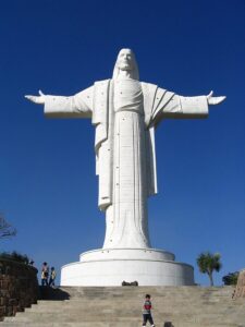 Cochabamba Travel Guide: Bolivia Culinary Capital, Cristo Statue, and the Largest Market in South America
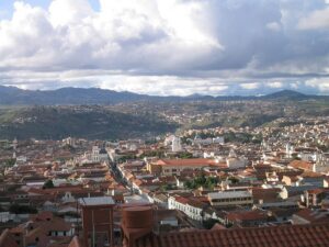 Sucre Travel Guide: Bolivia’s White City, Independence Capital, and Where to Slow Down
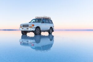 Uyuni and the Salar: A Friend’s Guide to the Three Day Salt Flats Tour
 Tarija Travel Guide: The Wine Country, Singani Distilleries, and the Mediterranean Side of Bolivia